Unique Combination of Hiking Guide Book and Maps App With GPS Guidance!
ADAC Wandern Tourscanner
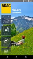
Use the unique combination of hiking guide book and card app with GPS tour! There is nowhere else: This app brings you the topographical map material that matches the respective tours in the ADAC hiking guides including dynamic GPS position information on your Android device. This makes your ADAC hiking guide the perfect digital all -round package, with which you are well equipped on every tour.
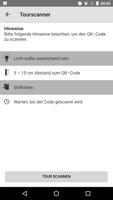
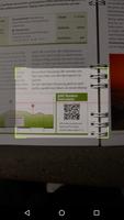
The well -known ADAC hiking guides (available everywhere in bookstores) contain a digital expansion with real added value for use with the ADAC Wandern Tourscanner ! Each tour is provided with a QR code that you can scan directly with this free app. With the scan, the topographical map material in the 1: 25,000 scale belonging to the respective tour is automatically loaded on your Android device (WLAN or mobile connection). The detailed tour of the tour is clearly marked on the map. But not only that: Your respective current position will always be displayed on the map on site so that you can orient yourself perfectly at any time. And best of all: Each of your tours is available on the go without mobile phone connection, as you can save the map material entirely on your Android device for offline use.
Can be used directly for the following ADAC hiking guide title with QR code:
- Allgäu
- Bavarian forest
- Lake Constance
- Chiemgau Berchtesgaden
- Dolomites
- Elbe Sandstone Mountains
- Franconian Switzerland
- Lake Garda
- Harz
- Catalonia
- North Black Forest
- Oberallgäu/Kleinwalsertal
- Oberbayern
- Odenwald
- Palatinate
- Rennsteig & Thuringian Forest
- Rhön
- South Black Forest
- South Tyrol / Merano & Vinschgau
- South Tyrol / Brixen & Dolomites
- Taunus
- Children's hiking guide Munich Hausberge and Voralpenland
- Children's hiking guide South Tyrol
The book titles that match this app are continuously added.
